Australian Bauxite
The Australian bauxite mines are:
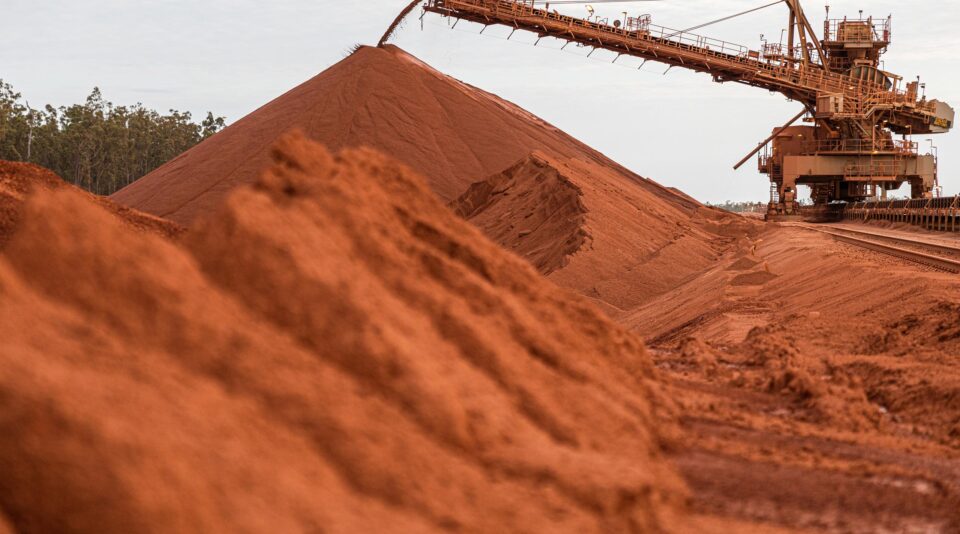
Australian bauxite deposits have high grades and are shallow and relatively easy to mine. To learn more about the bauxite mining process go to our Bauxite Mining Chart. The quality of Australian bauxite means there are a number of small new mines either operating or in the exploration and approvals phase in Australia including:
In 2018, the Australian Aluminium Council, together with the International Aluminium Institute and the Brazilian Aluminium Association, co-authored the Sustainable Bauxite Mining Guidelines, (updated Feb22) which aim to share the expertise learned from decades of sustainable mining practices in Australia with the global industry.
Click here for the latest publications from the International Aluminium Institute on best practice in the management of bauxite residue and reuse options.
Bauxite mining contributes to Australian prosperity and drives environmental research, regional workforce development, community partnership and innovative land rehabilitation. Case studies outline the work across the Membership in each of these, which you may find here.
The IAI / Biodiversity Consultancy have published a document: Metrics and data for bauxite mining to progress towards No Net Loss of biodiversity
Click here to read the document
Bauxite Exploration and evaluation
Exploration essentially involves outlining plateau areas with pre-Middle Tertiary planation surfaces that, prior to that time, were located in a humid tropical climate zone.
Economic lateritic bauxite deposits are relatively large in bulk tonnage (>50 Mt). They occur at or near the surface and are essentially flat lying. This makes them a target of significant areal extent, compared to deposits of other commodities (e.g., Mn, Cu, Zn etc).
Remote sensing methods that utilise satellite imagery, airborne geophysics, airborne hyperspectral mapping, aerial photography and digital terrain modelling can be used at a regional level.
Satellite imagery
Satellite imagery is used to define plateaux, drainage patterns and vegetation types. Henderson et al (1984) documented methods of exploration using LANDSAT MSS (Multi-Spectral Scanner) and LANDSAT TM (Thematic Mapper) data and used several Australian bauxite deposits as examples. LANDSAT TM has the advantage of a middle infrared (2.08-2.35 mm) wavelength sensor (Band 7) that can map clay-rich areas. Iron oxide-rich areas can be identified using the visible red wavelength bands (Band 3 for TM).
Airborne geophysics
Airborne geophysics can detect radiation generated by minerals at the surface via radiometric sensors. Resistant radioactive minerals like zircon and possibly monazite and xenotime can accumulate in the laterite/bauxite profile in very small quantities. If present at the surface, these minerals generate radiometric Th and U anomalies. However, this method, does not discriminate between ore grade bauxite and barren laterite (Figure 56). Medium to dense vegetation cover also reduces the effectiveness of this exploration tool.
Hyperspectral mapping
Hyperspectral mapping involves the collection of hyperspectral ground reflectance data from a conventional airborne geophysical platform (Hausknecht et al 2000) or satellite (e.g., JERS and ASTER). Commercial airborne sensors such as OARS (Operational Airborne Research Spectrometer), HYMAP, GEOSCAN and AMS (Airborne Multispectral Scanner) allow the identification of most species of phyllosilicates, clays, carbonates and iron oxides that occur in regolith and parent rocks. This technique has several advantages over satellite-generated data in that it has a higher signal to noise ratio, a higher pixel resolution (10 m compared to 30 m for TM), and more accurate integration with other geophysical data, because data acquisition is synchronous and georeferenced.
Spectra of common minerals found within the bauxite environment are shown in Figure 57. Note that the natural reflectance signatures of gibbsite and diaspore are similar but are lower than kaolinite, so that the use of ratios over selected bandwidths (e.g., difference between 0.5 μm and 1.2 μm) may be required to map bauxite minerals.
Aerial photography
Aerial photography can be used to map geological structures and lithologies, as well as important geomorphologic features such as planation surfaces, regolith and drainage.
Digital terrain models (DTM)
Digital terrain models (DTM) can be generated by a variety of methods, the most common being photogrammetry and satellite imagery (e.g., SPOT). Airborne geophysical and more specific airborne radar surveys (e.g., LIDAR) can also generate high quality DTM or digital elevation models (DEM) over relatively large areas. Airborne surveys are probably the most accurate and costly acquisition method. A DTM over a region with bauxite occurrences can identify nearby plateaux that have the same elevation as known occurrences and may therefore be prospective targets.
Regional follow-up work is required to verify the presence of bauxite and assess potential for economic quantities. Systematic sampling of natural outcrops is required to determine the quality of the material along strike and at various depths. Grid sampling is necessary if natural outcrops are limited. Before grid sampling is undertaken, a pit or costean might be excavated in the most prospective locality to determine the nature of the weathering profile and possibly the parent rock.
In summary the exploration process is:
- target generation (both regionally and from a landscape perspective),
- ground reconnaissance
- drilling on a progressive smaller grid (for example 500m spacing, 300m spacing, 150m spacing, 75m spacing etc),
- bulk sampling,
- resource/reserve estimation.